

What We Do?
The full service we are offering is specifically designed to meet your business needs and projects.
Data Capture using Lidar scanner
Photogrammetry
Save your time and money by choosing our professional team

Data Capture using Lidar scanner
A laser scanning process is the fastest method of 3D data acquisition for an existing building. Scan-to-BIM applied effectively considerably saves the time in the design phase compared to conventional on-site measurements. The conversion of scanned data of any building, façade, or terrain could be converted into BIM, creating a digital twin, enabling various automation and digitalization function related to design, construction or facility management.

Photogrammetry
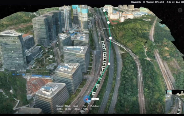
Assisted by drone-mounted scanner, massive amount data of up to 1km long can be documented and digitalised under DJI Terra to capture construction progress, machinery movement, identify safety lapses. Photogrammetry offer unique view points which are important for critical projects.